
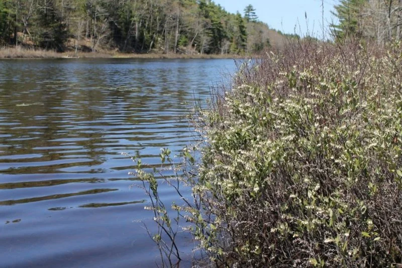
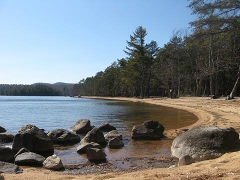
Local Natural Wonders - Day 37
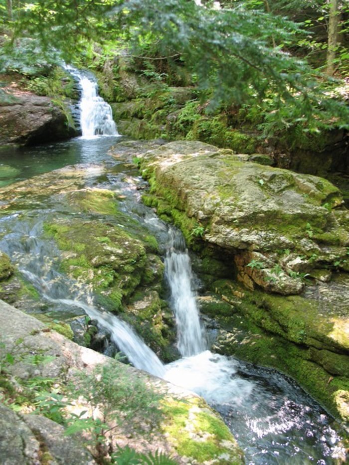
Blueberry Mountain and Rattlesnake Pool in Stow, Maine

Local Natural Wonders - Day 37 - Blueberry Mountain and Rattlesnake Pool in Stow, Maine
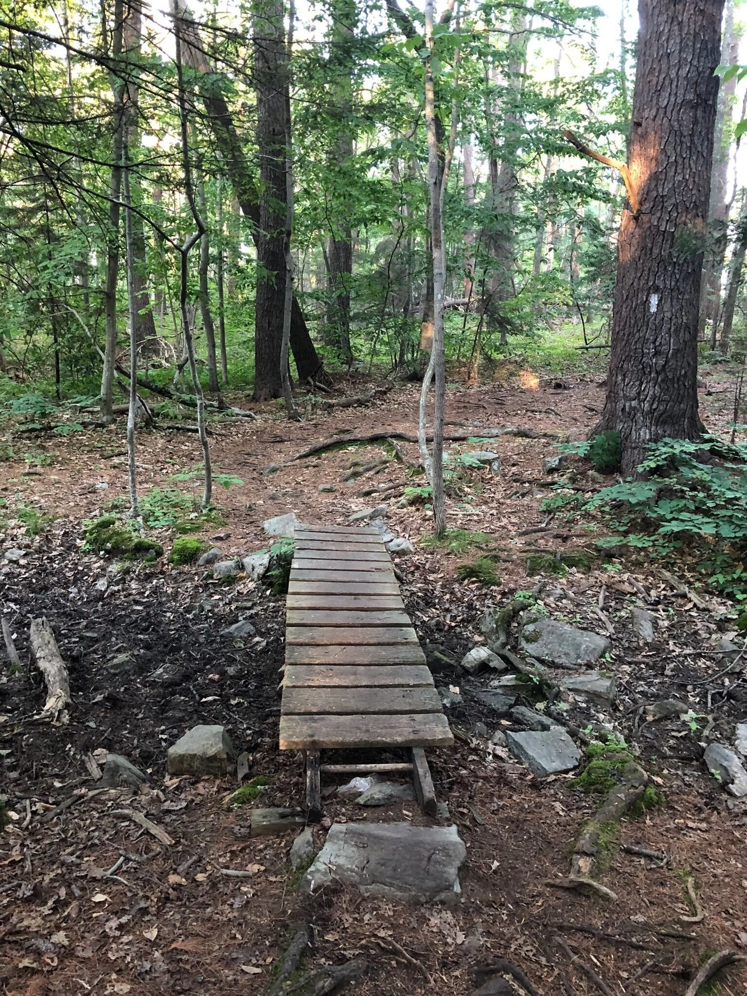
White Cairn Trail to Blueberry Ridge Trail:
This 3.9 mile loop trail has a little bit of everything—from a start in the woods, to a short but steep climb, to ridgetop views, picnic spots, and blueberry picking—this hike has it all. And to top it off, on the hike back to the trailhead, there is a short side trail to Rattlesnake Pool; one of the most idyllic, clear, and alluring swimming holes in all of Maine - complete with good jumping rocks for all ages.
If you’re not up for a long hike, but want to visit the pool, there is an option to do an easier in and back hike without summiting Blueberry Mountain.
From Fryeburg, Maine, take Route 113 North for 19.4 miles to Stone House Rd. (formerly Shell Pond Road); this will be 0.7 miles north of AMC Cold River Camp. Take a right onto Stone House Road, and follow for 1.1 miles to a locked gate with a small parking area on the right.
For More Information check out this website.
Local Natural Wonders - Day 36
Head of Tide Park in Topsham, Maine

Local Natural Wonders - Day 36 - Head Of Tide Park in Topsham Maine
The Cathance River is a hidden gem in the Land Trust’s service area of Brunswick, Topsham, and Bowdoin.
From Head of Tide Park, Cathance River Trail snakes along the river and through its uplands, providing views of the pristine river and its undisturbed natural surroundings. The trail leads to the impressive 60-foot aluminum Clay Brook pedestrian bridge which was locally designed and fabricated.
Across the bridge lie an additional five miles of trail at the Cathance River Preserve. Most of this trail is on privately owned, conserved land, so stay on trails and observe posted use restrictions.
Directions to Head of Tide Park:
Cathance Road, Topsham. Coming from the south, parking areas are located on the right just before short bridge over the river, and on the left just past the bridge (across from picnic table shelter).

Local Natural Wonders - Day 35
Wilbur Preserve in Phippsburg, Maine

Local Natural Wonders - Day 35 - Wilbur Preserve in Phippsburg Maine
This 10 acre preserve at the end of Cox’s Head road includes lovely woods and a stunning view from the summit. A 1/4 mile trail winds past a spring fed pond two thirds of the way to the summit which once provided water to the adjacent homes, and a Revolutionary War garrison on the summit. Your easy ascent begins amongst a wild Apple Orchard. The view from the summit includes all of Atkins Bay, the western coasts of Gerogetown, and to the south the Popham Colony area, Popham Village, and Fort Popham and the islands off the beach ( Phippsburg Land Trust.)
Directions:
From Rte. 209 at Winnegance proceed 4 miles to the Bisson’s Center Store and turn left onto Parker Head Rd. Follow Parker Head Road 4 miles to Cox’s Head Rd on the left. Proceed slowly on Parker Head Rd. as you turn off Rte. 209 (Center Village) and after you pass the cemetary on the left into Parker Head Village, the road is narrow and winding. Cox’s Head Rd. is gravel and also very narrow and winding, proceed .6 miles out Cox’s Head Rd., staying on the road and not turning into any of the cottage lanes, you will see a sign pointing to ‘Wilbur Preserve’ and the road becomes the Green Point Rd. Proceed .25 miles to the parking area on the left.
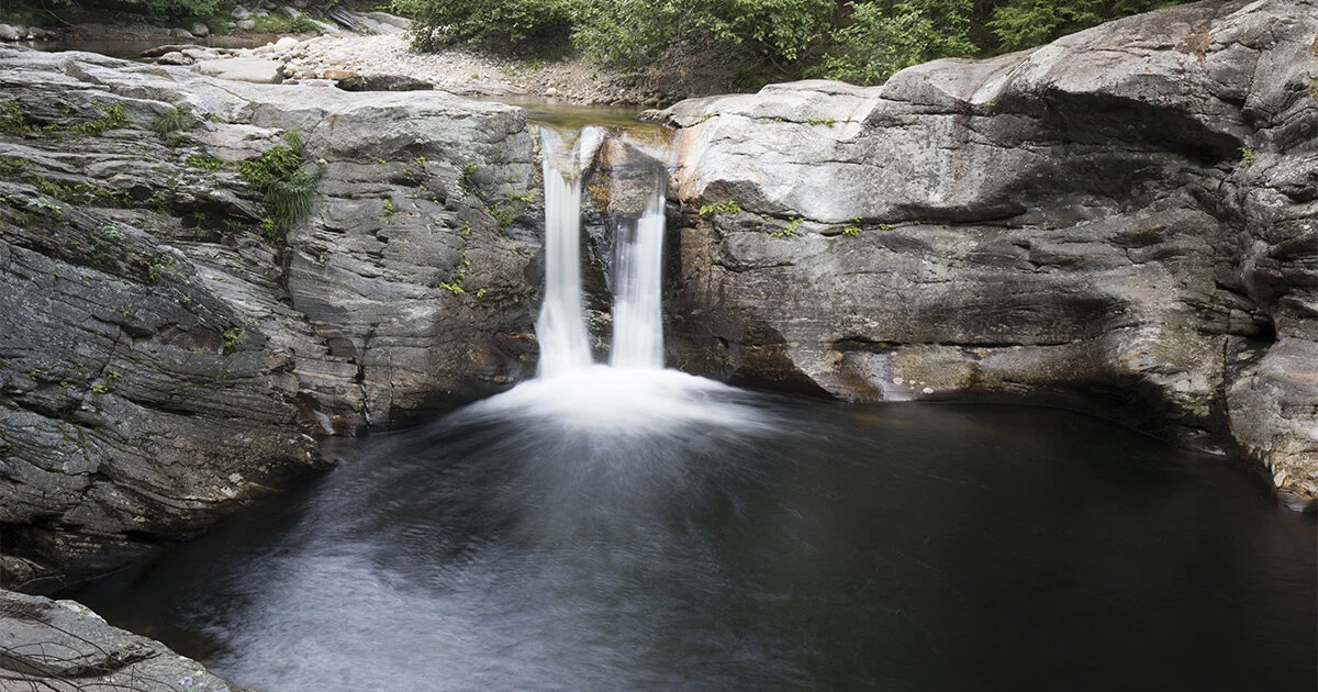
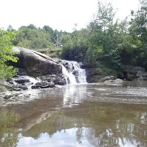
Local Natural Wonders - Day 34
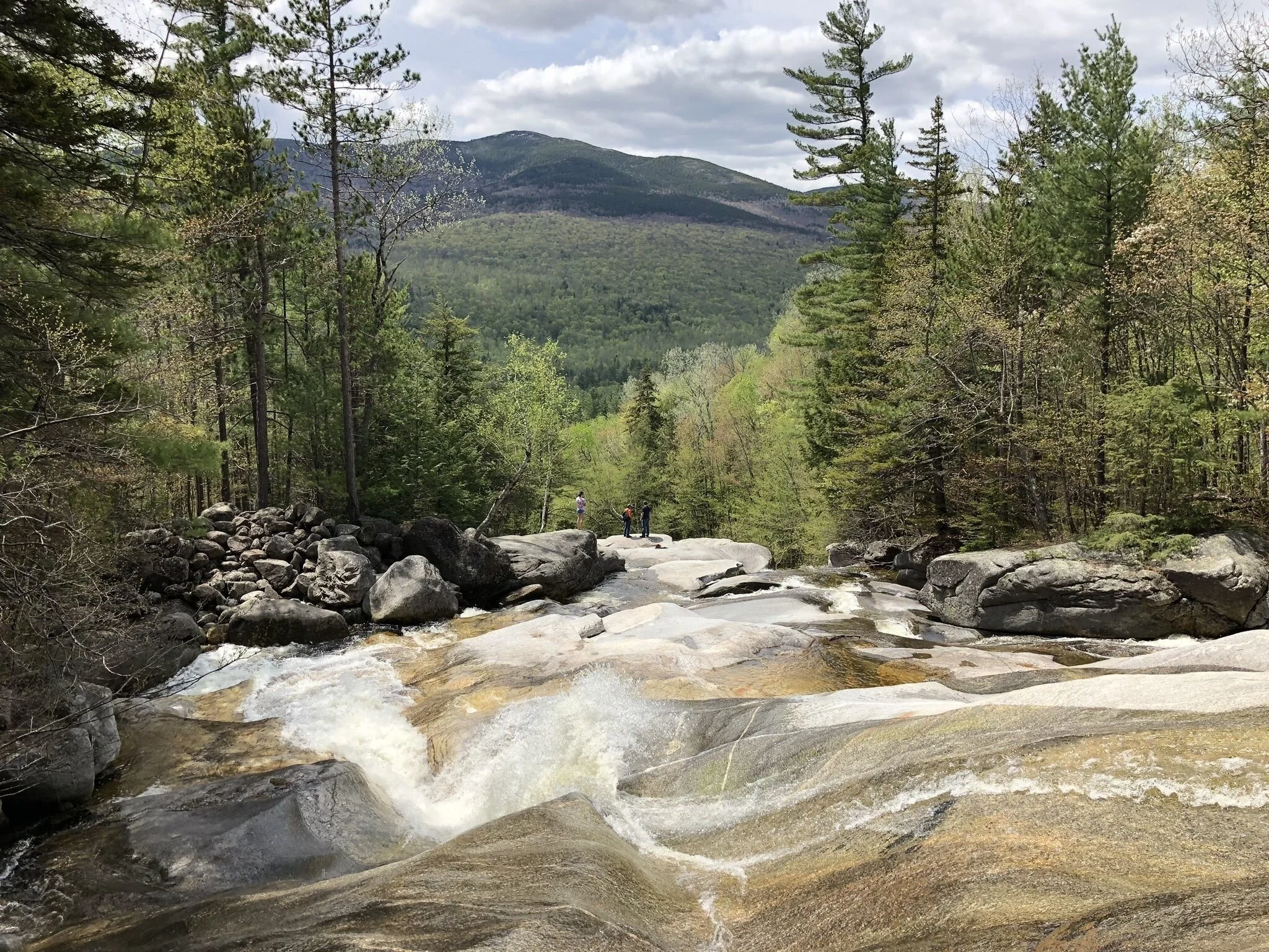
Frenchman’s Hole in Bethel, Maine

Photo: newenglandwaterfalls.com
Local Natural Wonders Day 34 - Frenchman’s Hole in Bethel, Maine
This beautiful spot in Bethel with high rocky ledges and deep clear water is perfect for a dip on a hot day in the cool water. There are spots to jump off the rocky cliffs into the water, or simply enjoy a picnic and the view. The shallower upper pool is great for kids.
From Wild Swimming New England: Fairly secluded spot in beautiful Bethel, Maine near Sunday River where the river coming off the mountain has made an astonishing basin, an outstanding swimming spot. The waterfall is a highlight but the very deep pool, with crystal clear water is not to be missed. Upper and lower holes.
DIRECTIONS: Go southeast on RT 2 about 16 miles through Newry to North Bethel. In North Bethel, turn right (northwest) on Sunday River Rd.. Set your odometer and proceed up Sunday River Rd., keeping to the right at any forks. At about 5.5 miles there is a nice swimming place by the road, called "The S". To continue to Frenchman's hole, you'll pass a historic and picturesque covered bridge until you come to twin logging bridges. Cross the bridges and take the first right turn. Proceed until you see parking area on your right. To access the lower hole, climb down the ledge and walk downstream.
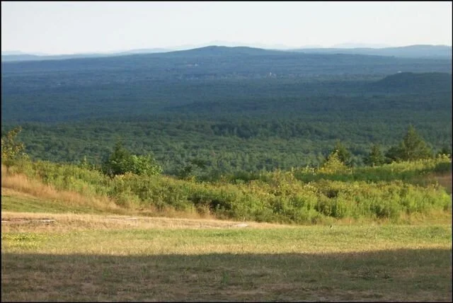
Local Natural Wonders - Day 33
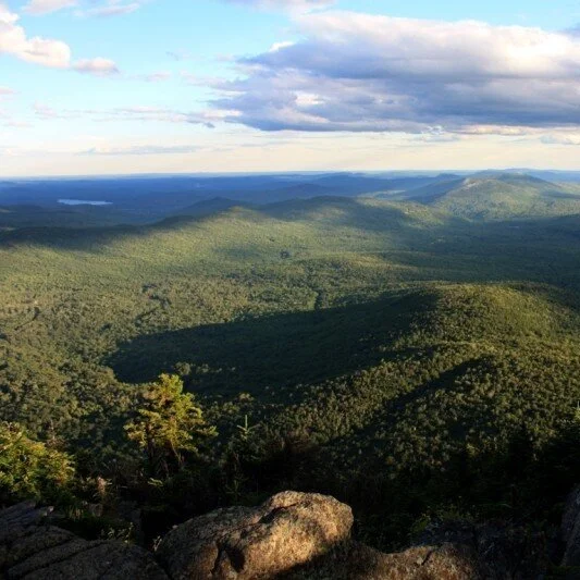
Mt. Agamenticus in Cape Neddick, Maine

Local Natural Wonders - Day 33 - Mt. Agumenticus in Cape Neddick, Maine
From the Mt. Agamenicus Conservation Region website:
The Mount Agamenticus Conservation Region consists of more than 10,000 acres and is located within an additional 30,000 acre expanse of conservation land in southern Maine. This land is comprised of a rich and unique coastal forest that supports the highest diversity of animal and plant species in all of Maine. The mountain and the surrounding area provide residents with an ideal location for hiking, biking and sightseeing. While most of Southern Maine is heavily developed, this stretch of conservation land is a natural treasure that will be preserved for the enjoyment of generations to come.
Trail Information (from Maine Trail Finder):
Turtle Loop (2.2 miles, moderate): The Turtle Loop includes a self-guided interpretive trail featuring 15 information stations highlighting many of the unique natural, geological, and cultural history of Mount Agamenticus. Start at Ring Trail located at the southern base parking area. Proceed up Ring 0.1 miles and turn left at intersection to cross summit road. Continue westerly passing Blueberry Bluff intersection. At 0.4 miles there is a scenic overlook that presents an unobstructed view to the West. Passing the overlook Ring Trail turns northerly and passes Wintergreen, Fisher, Vultures View and Sweet Fern intersections before reaching the half way point at Goose Foot/Chestnut Oak crossing. Continue on Ring for 0.15 miles and turn right onto Witch Hazel Trail. Climb 0.4 miles to the summit of Mount Agamenticus. After enjoying the summit views, continue back down Witch Hazel Trail and turn right back onto Ring Trail. Proceed southerly 0.7 miles past Rocky Road/Hairpin Trail crossing, a summit road parking area, and past the first intersection of your loop to return to the base parking area.
Bear Loop (3.2 miles, moderate-advanded): This loop utilizes old roads to run along old rock walls and abandon cellar holes. The route starts in a dominantly hemlock forest and changes to a mix forest of pine and oak old growth. Start at Cedar Trail located at western base parking area. Proceed 1 mile along Cedar Trail (passing Goosefoot which is the return trail) over three small boardwalk bridges. Turn right onto Porcupine Trail and proceed for about 1 mile, passing Second Hill intersection to Chestnut Oak Trail. Turn right onto Chestnut Oak and proceed 0.3 miles until it ends at Ring/Goosefoot/Chestnut Oak crossing. Take Goosefoot 0.7 miles back down hill, passing Vultures View Trail to Cedar. Turn left onto Cedar and follow 0.3 miles back to parking area.
Click Here for a trail map.
Click Here for directions.
Local Natural Wonders - Day 32
Lilly Pond Forest in Bath, ME

Photo credit: https://www.kennebecestuary.org/
Local Natural Wonders Day 31 - Lilly Pond Forest in Bath, Maine
Part of the Kennebec Estuary Land Trust (KELT), Lilly Pond Community Forest has three miles of trails for hiking and biking. This preserve protects 900 feet of Lilly Pond frontage and includes shaded rocky forest, wetland forest and open wetlands. The beginning of the trails includes a steeper incline with steps leading from High Street and trails are considered mostly intermediate.
Directions from KELT:
Take High Street south and turn left onto Marshall Street, where parking is available at Goddard Park on the left. Then walk south on High Street on the sidewalk approximately 500 feet, just past Getchell Street, to the preserve entry at the wooden stairs on the right. View Map.

Local Natural Wonders - Day 31
Maquoit Bay Conservation Land in Brunswick, ME
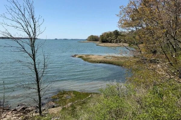
Photo credit: nrcm.org
Local Natural Wonders Day 31 - Maquoit Bay Conservation Land in Brunswick, Maine
Maquoit Bay Conservation Land is a 124-acre preserve owned by the Town of Brunswick and protected through conservation easement with the Brunswick-Topsham Land Trust (BTLT). This land is comprised mostly of woodlands and some salt marshes. It has a mile-long looped trail for walking, snowshoeing or cross-country skiing along an old woods road, as well as gorgeous views of Maquoit Bay on the Maine coast. Where the trail meets the coastline, hikers will find Rocky Point, a unique rocky promontory. This location is an ideal spot for swimming at high tide in the warm waters of the shallow bay.
DIRECTIONS & TRAIL USE RESTRICTIONS FROM BTLT:
Directions to Maquoit Bay Conservation Land: from downtown Brunswick, follow Maine Street southeast for approximately 1.6 miles. Continue onto Mere Point Road for 0.2 miles and then bear right onto Maquoit Road. Follow Maquoit Road for 1.9 miles and then turn right onto Woodside Road. Follow Woodside Road for 0.5 miles and then take first left onto Bunganuc Road. Property is on the left in about 0.5 miles and has an established gravel parking area with road signage.
Trail Use Restrictions:
Open dawn to dusk
No off-road vehicles, bicycles, snowmobiles, or horses
On-leash dogs permitted (dog waste removal required)
No fires or camping
Stay on marked trails
Hunting permitted
Observe posted trail rules
Local Natural Wonders - Day 30
Reid State Park in Georgetown, Maine

Local Natural Wonders - Day 30 - Reid State Park
Reid State Park in Georgetown, Maine is a huge and beautiful park. It has a lagoon for swimming, a sandy beach, rocky cliffs and even a river. This is a great place to spend a summer day with the family or take a long hike. It is even a great place for cross country skiing in the winter.
From Maine.gov:
Reid State Park bears the distinct honor as being Maine's first State-owned Saltwater Beach. In 1946, prosperous businessman and Georgetown resident Walter E. Reid donated land to the State of Maine to be preserved forever, and a few years later Reid State Park became a reality.
Today, thousands of visitors enjoy the park's long, wide sand beaches like Mile and Half Mile, which are rare in Maine. Enjoyed as a recreational resource, the beaches are also essential nesting areas for endangered least terns and piping plovers and resting and feeding areas for other shorebirds. Rarer than beaches along Maine's coast are large sand dunes, like those at Reid. For a geologic tour of the beaches visit The Geology of Mile and Half Mile Beaches. Learn about the geology of the area on the interactive Maine Geologic Facts and Localities map.
From Maine Trail Finder:
The park offers two trails popular with hikers and bicyclists. The 2.14 mile Ski Loop Trail is best accessed from the Todd's Point Road. It makes a loop through the northern area of Reid State Park, primarily a mixed growth forest, with one section abutting a sizeable pond and bog area. Across the road from the pond is a historic one-room school house which is rich in history. As conditions allow, this trail is groomed in the winter for cross country skiing.
The Little River Trail, a 1.4 mile trail, can be accessed from Todd's Point. It follows the meandering Little River, which is home to a wide array of birds that feed on the small fish and plants of this area. Both trails have some moderate sections to hike with some exposed roots and rocks. The trails are relatively flat with a few small hills to climb.
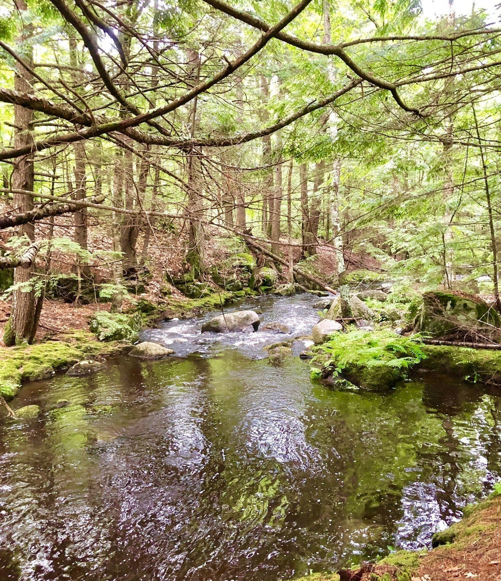
Local Natural Wonders - Day 29
Great Falls Preserve in New Gloucester, Maine

Local Natural Wonders Day 29 - Great Falls Preserve in New Gloucester, Maine
Great Falls Preserve is a 40-acre preserve in New Gloucester maintained by the Royal River Conservation Trust. Here you will find a 1.5 mile loop trail that includes a scenic waterfall at the mouth of a small wading pool. Glacial erratics, or boulders, and ledges create a bridge of land between two large wetland areas: marshes and beaver ponds. This is an easy hike with many natural features to enjoy along the way.
Directions, Parking and Trail Info from Royal River Conservation Trust:
Parking is available on the right-hand shoulder of Woodman Road, at the northern end of Woodman Road in New Gloucester. Please respect neighbors parking signs: “no parking beyond this point.” GPS Address for parking and trailhead: 381 Woodman Road, New Gloucester.
The 1.5 mile primitive loop trail follows the discontinued end of Woodman Road (today a woods road and driveway) before turning right into the woods, following the stream, and looping back onto the woods road to return to the parking area.
The trail is in good shape! In spring or after rains the woods road has some puddles that require jumping. Going out and back along the stream might be more enjoyable than using the woods road, but the woods road loop is delightful too.
Private Norumbega Chapel trails — private but open to the public — linked to Norumbega Cidery & Yurts leave the woods road on the LEFT, with variable signage and variable maintenance. (RRCT public trails leave the woods road on the RIGHT.) Please respect all signs and postings by all abutters. The Norumbega trails are mapped and promoted on Maine Trail Finder, and on RRCT’s Big Falls Maps, and with on-site signage.

Local Natural Wonders - Day 28
Hacker’s Hill Preserve in Casco, Maine

Local Natural Wonders - Day 28 Hacker’s Hill Preserve in Casco, Maine
Maintained by Loon Echo Land Trust, Hacker’s Hill is a 27-acre preserve with trails and scenic viewing open to the public. Beautiful vistas of the White Mountains and Lakes Region can be found from the top of the hill (753ft elevation). Keep in mind that the Hacker’s Hill Preserve gate that gives vehicle access to the top is open is open Monday, Wednesday, and Friday, Sat & Sun 8:30 a.m.to sunset and closed Tuesday and Thursday. When the gate is closed, park along Quaker Ridge Road and walk up through the gate.
The preserve offers some trails, picnic tables, and fields with wildflowers. At this time, restroom facilities are closed.
Preserve & Trail Map
Local Natural Wonders - Day 27
Robinson Woods near Cape Elizabeth, Maine

Local Natural Wonders - Day 27 Robinson Woods near Cape Elizabeth, Maine
Robinson Woods is an extensive trail network within 80 acres of woodland, offering recreation opportunities in woods and wetlands. Hike or bike and observe “vernal pools, spring wildflowers, old-growth trees, and a variety of plant and animal habitats.” Trails range from flat and wide to winding and hilly. Outer Loop trail is a 1.4 mile loop that features a river and is ideal for different skill levels. View various trails here.
DIRECTIONS from Trailforks.com: The trail head is located at the intersection of Shore Road and Belfield Extension in Cape Elizabeth.
Local Natural Wonders - Day 26
Mt. Blue in Weld, Maine

Local Natural Wonders - Day 26 - Mt. Blue Trail at Mt. Blue State Park in Weld, Maine
If you’re looking for a relatively short but challenging hike with an amazing view, Mt. Blue is perfect. Located in Mt. Blue State Park, surrounded by lakes and mountains, and coming in at 2.8 miles round trip, this is a very rewarding hike. It is short, but strenuous and steep at times, so is best for older children and somewhat experienced hikers. Be sure to pack plenty of water and an extra layer of clothing as it can be quite windy at the top.
Get Directions Here.
For more information check out the Mount Blue State Park website Here.
Local Natural Wonders - Day 25
Step Falls in Newry, Maine

Photo Credit: Dominic Marino Wadinambu on Alltrails.com
Local Natural Wonders Day 25 - Step Falls in Newry, Maine
Step Falls runs through a 24-acre preserve managed by the Mahoosuc Land Trust. This 1.1 mile out and back, forested hike includes waterfalls, natural water slides and swimming holes surrounded by slabs of granite. It’s like a natural water park! It is a fairly easy hike with a few rocky steep areas that require a bit of rock scrambling. The water is very cool, clear and perfect for a swim to cool off.
Weekends here can be busy, especially in the summer, so if you prefer encountering fewer people on your hike you may want to explore Step Falls on a weekday.
Local Natural Wonders - Day 24
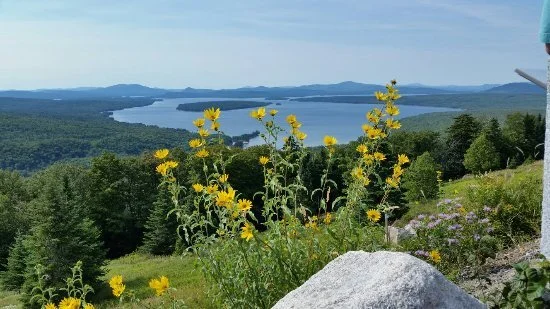
Height of the Land in Rangeley, Maine

Photo Credit: Trip advisor
Local Natural Wonders Day 24 - Height of the Land in Rangeley, Maine
Located in western Maine near Rangeley, there is an incredible vista in the 512-acre Rangeley Lakes Heritage Trust preserve. The preserve includes a portion of the Appalachian Trail and amazing views of mountains, forest and lakes. You may even catch a bald eagle soaring off in the distance. The Height of the Land can be found on Route 17 on the Rangely Lakes Scenic Byway. There is a pull-off area for parking. If you are in this area, be sure to stop at this spot, which has been declared one of the finest vistas in the state, and even New England.
Local Natural Wonders - Day 23
Sebago Lake State Park, Sebago, Maine

Local Natural Wonders - Day 23 - Sebago Lake State Park in Casco, Maine
Sebago Lake State Park is a great spot on one of Maines largest lakes for swimming, hiking, biking and camping. For day use, the entrance to the park is in Casco, Maine. Clean water for swimming, sandy beaches and wooded trails make this a great place to spend the day.
More Information From Maine.gov:
Sebago Lake State Park opened to the public in 1938 as one of the five original state parks. This forested lakeside park is situated on the shore of Maine's deepest and second largest lake which provides year-round recreation for thousands of visitors each year. Near the foothills of the White Mountains, the park's 1,400 acres features sandy beaches, extensive woodlands, ponds, bogs a river and diverse habitat for a wide variety of plant and animal life.
Swimming, sport fishing, camping and boating are some of the summer activities enjoyed by visitors. The park's 250-site campground is a popular destination for family vacationers and provides lasting memories season after season. Wooded areas offer a respite from the sun and activity on the beaches. Whether hiking on marked trails or bicycling on park roads, visitors find many way to enjoy the park. The park also operates the historic Songo Lock.
Carved by ancient rivers and scoured by Ice Age glaciers, Sebago Lake fills a basin made of granite that has been weathered for millions of year. Thanks to those glaciers, visitors today an enjoy an array of water sports on Maine's 45 square mile lake. For a guided tour of the of the geological features visit The Geology of Sebago Lake State Park.