
Local Natural Wonders - Day 22
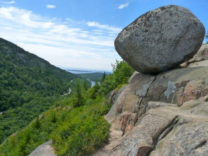
Bubble Rock in Acadia National Park, Maine

Photo Credit: thegaffneys / Flickr
Local Natural Wonders Day 22 - Bubble Rock in Acadia National Park, Maine
Located inside Acadia National Park there is a "glacial erratic" - now called Bubble Rock - left by ice age activity a long time ago. Geologists state that glaciers carried Bubble Rock to its perch from the town of Lucerne, Maine - 40 miles away!
You will need to hike to the top of South Bubble (768ft elevation) inside Acadia National Park to reach Bubble Rock. Parking is located on the Loop Road. Follow the South Bubble Trail (.7 miles) to the summit, and continue on for a couple more minutes on a side trail that leads to Bubble Rock. You will also have a fantastic view of Jordan Pond.
For more information and directions click here.
Local Natural Wonders - Day 21
Runaround Pond in Durham, Maine

Photo Credit: alltrails.com
Local Natural Wonders Day 20 - Runaround Pond in Durham, Maine
Runaround Pond, located at 315 Runaround Pond Road in Durham, Maine is part of a larger, 374-acre conservation area that also includes Chesley Meadows Preserve. The pond is perfect for any type of paddling and fishing, ice-skating and ice-fishing in winter, and it is surrounded by trails to walk or mountain bike on. Park at the Runaround Pond recreation area and go for a paddle, enjoy the scenery from a spot on the rocks or picnic table on the shore, or follow the marked trails.
The Royal River Conservation Trust offers a lot of information here on this land and its use, including this:
“The trail and boating-skating network at the eastern end of Runaround Pond begins and ends at the 133-acre town recreation area with an accessible bathroom, picnic tables, hand-carry boat access, fishing ledges, and good parking plowed year-round. The walking trail is wide and flat and generally suitable for baby carriages and gentle walking. Small and large loop trails allow exploration of the shoreline of the pond and the shoreline of Chandler Brook. The trails pass near historic cellar holes, the retaining walls of the old mill, the historic granite dam, and quarries. The large loop marked by blue blazes is 0.6 miles in length, looping both north and south from the parking area. Paddling and skating begins at the recreation area, or scroll to tabs below for paddling Chander Brook from its Runaround Pond outlet.
To get to the parking area at Runaround Pond Recreation Area from I-295, take Exit 22 in Freeport/Durham. Turn right onto ME-136 North and drive 6.2 miles. Turn left onto Rabbit Road and continue onto Runaround Pond Road for 1.1 miles. Look for the entrance to the parking area and boat launch on the right. The blue blazed trails leave from both ends of the recreation area’s parking lot.”
Local Natural Wonders - Day 20
Pemaquid Beach in New Harbor, ME

Photo Credit: Photo credit: https://www.pinterest.com/pin/198228821068851436/
Local Natural Wonders Day 20 - Pemaquid Beach in New Harbor, Maine
Pemaquid Beach is owned by the Town of Bristol in midcoast Maine. It is operated by the Bristol Parks Commission for the Town of Bristol and a "sister" park to the Pemaquid Point Lighthouse Park.
Located about an hour north of Freeport on the coast, this beach has beautiful clear water and the sand is groomed daily. There are changing rooms and showers, as well as an outdoor shower to rinse feet and legs. Guests with mobility issues can request to be taken onto the beach in the "Gator.” There is a $5 fee per person age 12 and up.
Since 2003, the Parks Commission has been partnered with the Pemaquid Watershed Association to offer a nature center called "Beachcombers' Rest". Located inside the beach pavilion, the nature center features exhibits and displays describing the ecology of the beach.
Local Natural Wonders - Day 19
Thorne Head Preserve in Bath, Maine

Local Natural Wonders - Day 19 - Thorne Head Preserve, Bath Maine
Located at the end of High Street in Bath, Maine is this beautiful preserve. Follow a series of trails through a mixed wood forest to a stunning view overlooking the Kennebec River Estuary. This is a great hike for kids, and a perfect place to go for a quick ,but rewarding, local hike.
Description (From Maine Trail Finder)
Thorne Head Preserve is conveniently located at the confluence of the Kennebec Estuary and Whiskeag Creek, at the northern end of the City of Bath. From the parking lot, a series of trails are available to the visitor, varying in difficulty from the easily accessible fifteen-minute Overlook Trail to the 5.1 mile Whiskeag Trail that connects Thorne Head Preserve to the Bath Area Family YMCA. With water bodies to the east, west, and north, visitors have great views of the estuary and the wildlife that rely on the preserve and the waterways.
Other interesting attractions at Thorne Head include the Mushroom Cap Trail and Murderer's Cave. A trip to Thorne Head can mean a thirty-minute walking trip down Overlook Trail and back, or a day full of exploration of the various secrets that the property harbors.
6 Natural Features Of Thorne Head (From the Kennebec Estuary Land Trust website)
Fresh Water Marsh: Just north of the main gate, this habitat supports migrating birds, feeding ducks, and is home to aquatic amphibians.
Mixed Woods: Old white pine, hemlock, oak and maple trees shelter migrating warblers and nesting birds requiring unbroken large tracts for protection. Owls hoot from woodland perches. Bald Eagles frequent tall trees at the water’s edge.
Vernal Pools: Spring Peepers, Wood Frogs and Spotted Salamanders lay eggs in pools that disappear in late spring, aiding survival of species that would be fish food in permanent ponds.
Tidal Wetlands: A highly productive ecosystem and habitat for many types of wildlife including waterfowl and wading birds. Thorne Head wetlands are home to two endangered plant species that thrive in diurnal inundations, parker’s pipewort, and estuary bur-marigold. Wild rice attracts thousands of migrating ducks in late summer and fall. Fish fry seek protection in the wetlands.
Riparian Areas: Land adjacent to waterways is used by 85% of Maine’s vertebrates. Amphibians populate the North Creek Outlet, a stream that may be viewed from the wooden foot bridge shown on the map.
Kennebec River Estuary: An estuary is the area of a river system affected by marine tides. The Kennebec estuary is known for 9 anadromous species; those inhabiting the river for part or all of their lives, including striped bass, now part of a world class fishery, and short nosed sturgeon, a protected, endangered species. Sturgeon may be recognized by the bony external shields along flank and back. You may see these fish breach in the fast flowing currents.
For Directions, a map and more check out the Kennebec Estuary Land Trust.
Local Natural Wonders - Day 18
Littlejohn Island Preserve in Yarmouth, Maine

Photo: carefree-creative.com
Local Natural Wonders Day 17 - Littlejohn Island Preserve in Yarmouth, Maine
Littlejohn Island Preserve is 23 acres, owned and managed by Royal River Conservation Trust. This coastal preserve includes a fairly flat and wide 1.3 mile trail with scenic views and access to the rocky shoreline. Visitors will likely see a variety of migrant birds and may even catch a bald eagle or osprey along the shore. There are even a few picnic tables - a perfect place to enjoy lunch with a view!
Parking is very limited here, so it is best to go during off-peak hours (avoid weekends in the summer), and if you find the small parking lot full, you can park on Cousins Island and walk to the trailhead or explore other trails on Cousins Island.
Please note these parking restrictions from RRCT:
“Parking rules are simple: four cars only. Only in the parking lot. Sunrise to sunset. Never on the shoulders. Never at the end of the lane. Parking is typically at capacity during both summer and winter weekends; please visit our other preserves, or plan to walk or bicycle from your home, or from head-of-island parking spots. This preserve is frequently at capacity, any time of day, any time of year, requiring visitors arriving by car to turn around and go elsewhere. The parking lot is strictly closed from dusk to dawn. Police take notice.
The preserve has only one small parking lot, just before the stone gate, limited to four cars. If the parking lot is full, as it often is, please return to the either end of either the Cousins or Littlejohn causeways for parking, or explore other beaches and preserves. Please never park on any road shoulders, even those shoulders that are not signed for “no parking.” The Royal River Conservation Trust (RRCT) does not own the road or road shoulders, not even those mowed road shoulders that abut our preserve ownership or our preserve parking. RRCT does not invite, nor do road owners allow, any party to park on the road shoulders or the end of the lane.”
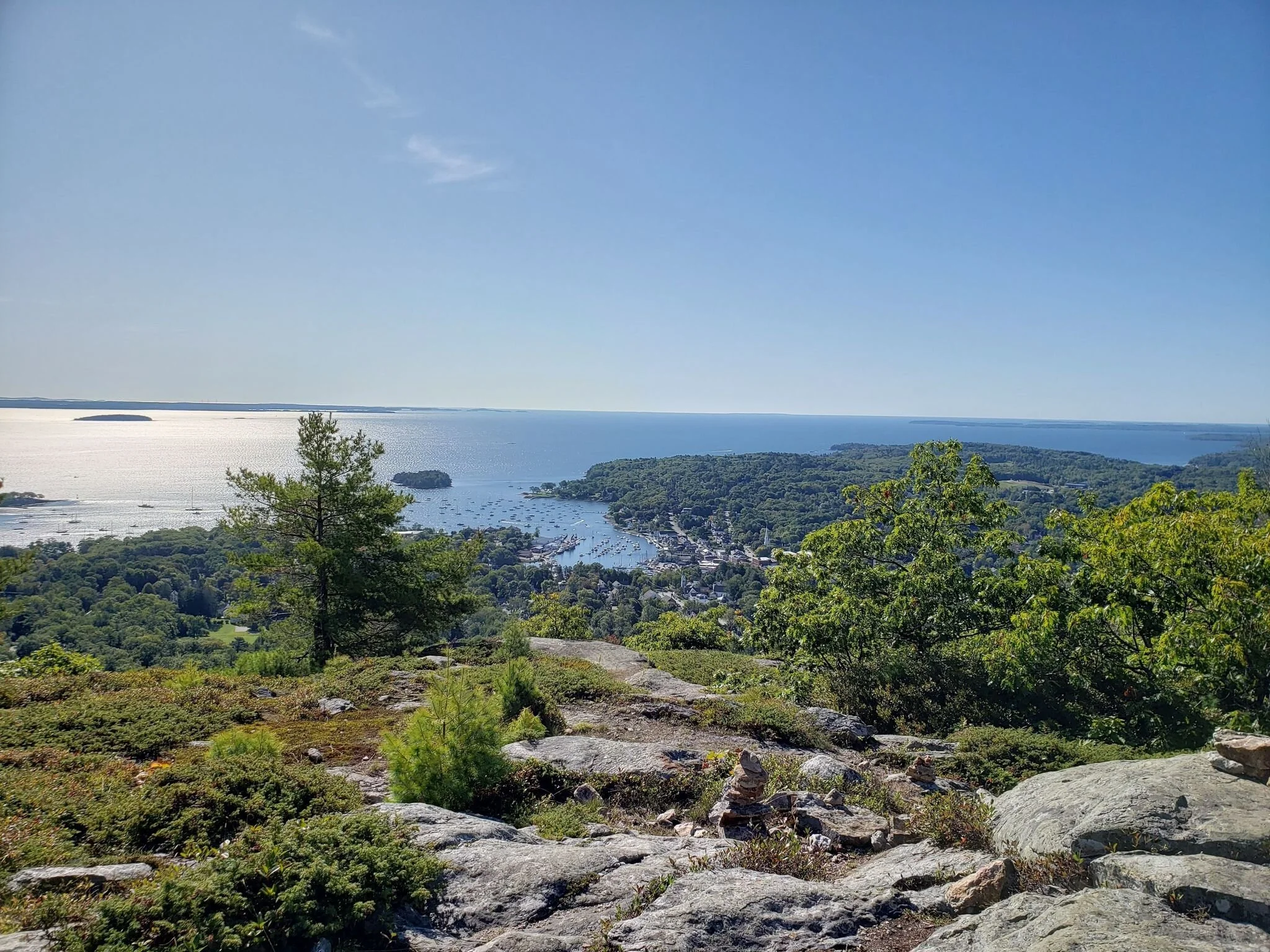
Local Natural Wonders - Day 17
Mount Battie in Camden, Maine

Photo: Alltrails.com, Richard Stark
Local Natural Wonders Day 17 - Mount Battie in Camden, Maine
Mount Battie is located in Camden Hills State Park. There are a couple of trail options - Nature Trail and Mount Battie Trailhead. Nature Trail is a 2.6 mile loop, with a few steeper spots. Nature Trail parking is accessed from Mount Battie Road (DIRECTIONS). Mount Battie Trailhead is a short hike - only a half mile. Parking for this hike is located at the end of Megunticook Street (DIRECTIONS). Both offer gorgeous views of Penobscot Bay, offshore islands and Camden.
If you prefer to DRIVE up to the top of Mount Battie - you can! Just follow Mount Battie Road from Camden Hills State Park Campground and park at the top.
Local Natural Wonders - Day 16
Stovers Point Preserve in Harpswell, Maine

Local Natural Wonders - Day 16 - Stovers Point Preserve, Harpswell, Maine
Stovers Point Preserve is a great little off-the-beaten-path beach in Harpswell. It is a great place to collect rocks and shells, check out some crabs, and go for a swim. This spot provides a beautiful view, a tidal creek, and a salt marsh as well as ocean swimming on a little rocky beach.
From the Harpswell Heritage Land Trust Website:
If you are looking for a day at the beach, try Stover’s Point Preserve! It’s free to visit and fun for all. With the convenience of being able to drive onto the gravel beach, this is a great place for all ages to spend a day exploring, swimming, sunbathing, skipping rocks, launching a kayak or SUP, and breathing in the salty ocean breeze. A tidal creek provides a protected area for kids to swim in water that’s a little warmer than the open ocean. The view across Harpswell Sound to the unique Cribstone Bridge connecting Orr’s and Bailey Islands is spectacular. Bring water shoes to protect your feet from barnacles and rocks.
Stover’s Point Preserve forms a barrier that shelters a small salt marsh from the waves. Salt marshes are unique, productive and sensitive habitats with plants and animals that are adapted to the changing tides and water conditions. Grasses grow well here, forming the base of a food web that includes fish, birds and shellfish. Please do not park on the sensitive marsh grass.
Please note that there are no bathroom facilities, shelters, picnic tables or trash cans at Stover’s Point Preserve. The nearest public bathroom is at Mitchell Field, 2.5 miles north on Harpswell Neck Road.
Directions:
Click here to get directions from Google Maps.
Stover’s Point Preserve is located at approx. 69 Windsor Lane, Harpswell. From the intersection of Rt 123 and Bath Rd at Bowdoin College in Brunswick, follow Rt 123 south for 12.2 mi. Turn left on Stover’s Cove Rd. Take your first right on Stover’s Point Rd. Veer left. Stay straight then follow the road as it curves to the right. Turn left on a gravel road. This road is Windsor Lane but is not marked. Being very careful of the undercarriage of your car, drive right onto the beach. The road leading to the beach has rocks, sand and a large section of ledge that you must cross. Once on the beach, please park on gravel surfaces only.
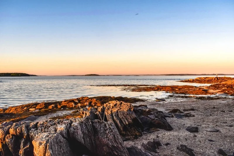
Local Natural Wonders - Day 15
Giant’s Stairs on Bailey Island, Maine

Local Natural Wonders Day 15 - Giant’s Stairs on Bailey Island, Maine
Giant’s Stairs is a unique rock formation within the rocky shoreline, overlooking Casco Bay. A short easy trail takes you along the shore to Giant’s Stairs and Thunder Hole, both worth visiting at this gorgeous location. We recommend packing a picnic lunch to enjoy while you are there.
This trail is part of the Harpswell Heritage Land Trust’s McIntosh Preserve and Giant’s Stairs are managed by the Town of Harswell.
From the Harpswell Land Trust website:
The rock formations here are a geologist’s dream, but even a layman can appreciate the gigantic forces that shaped this coastline going back 500 million years. Layers of mud formed the original sedimentary rock, along with deposits of minerals that later crystallized into quartz and garnet. Movements in the Earth’s crust pushed the rock layers upward, causing massive buckling and cracking. Gradually, hot magma from deep below the surface flowed into one large crack and formed a vertical seam of dark basalt rock, known to scientists as an “intrusive volcanic dike.” Erosion of the basalt during 200 million years led to what we now call the Giant’s Stairs.
DIRECTIONS:
Parking is located at 19 Ocean Street, Bailey Island. From Cook’s Corner in Brunswick, follow Rt 24 south for 14.5 miles, crossing the Cribstone Bridge. Turn left on Washington Ave. Please be respectful to the land owners surrounding this property. Park at the Episcopal Chapel at the intersection of Washington Ave and Ocean St (except during services) or at the four designated spots along Washington Ave. MAP
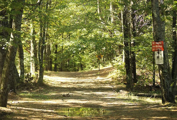
Local Natural Wonders - Day 14
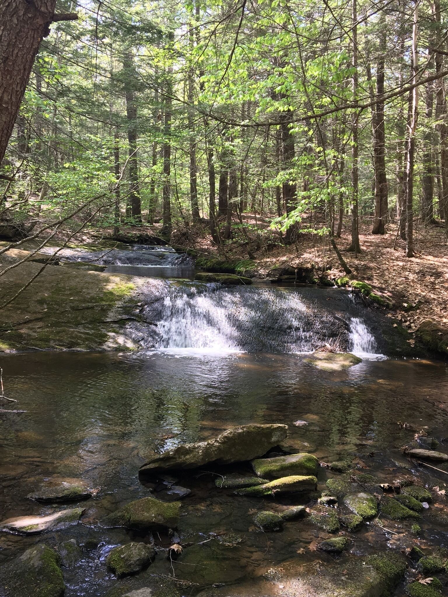
Rines Forest Trail in Cumberland, Maine
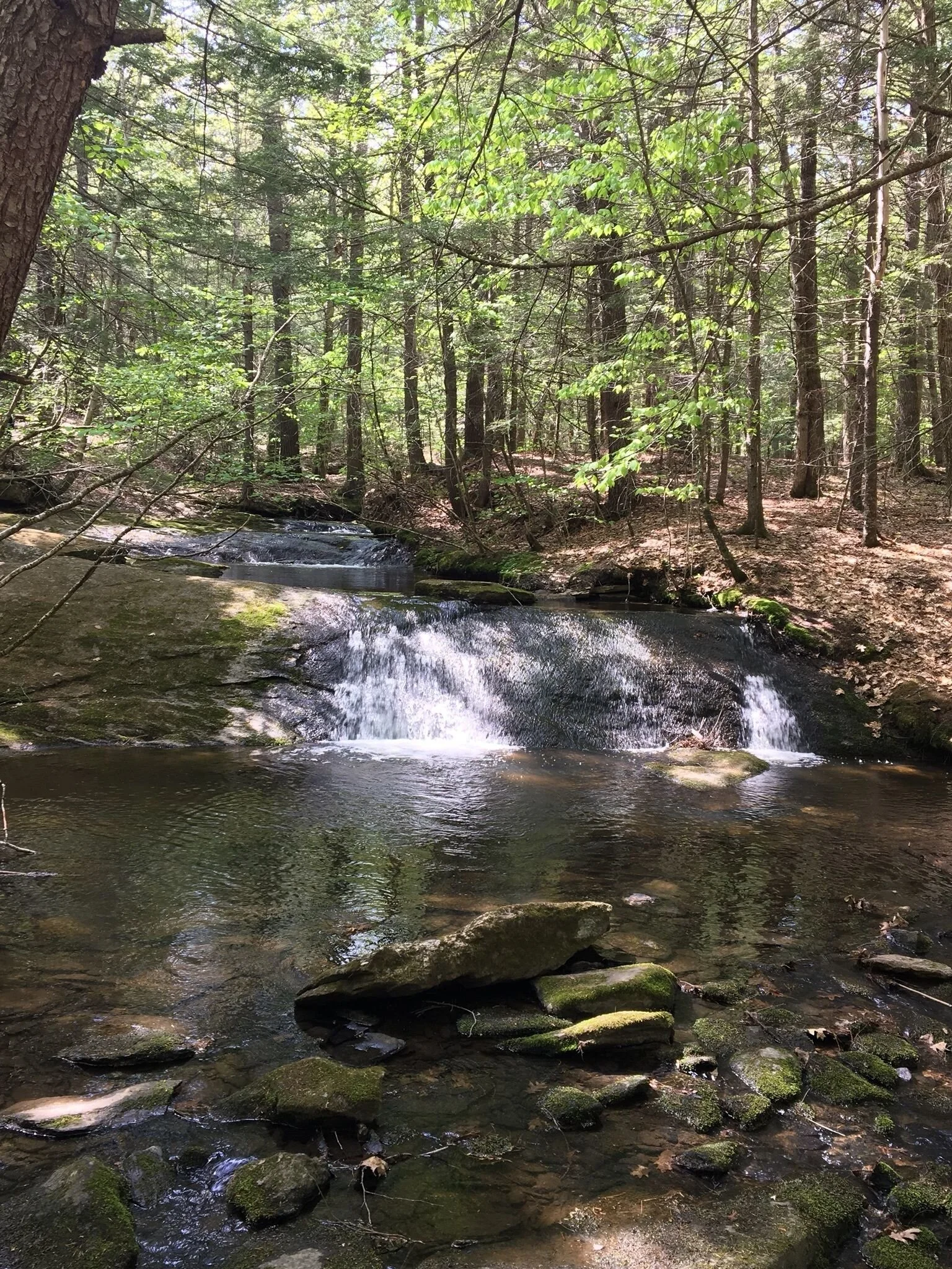
Photo: AllTrails.com
Local Natural Wonders Day 14 - Rines Forest Trail in Cumberland, Maine
Rines Forest Trail is an easy loop trail with a few steep hills - perfect for a short hike or mountain biking. There are actually a couple of trail options that lead to a creek, waterfall and small pools, and it’s helpful to take picture of the trail map before you begin. This area can be buggy, so pack some bug spray and enjoy this beautiful walk!

Local Natural Wonders - Day 13
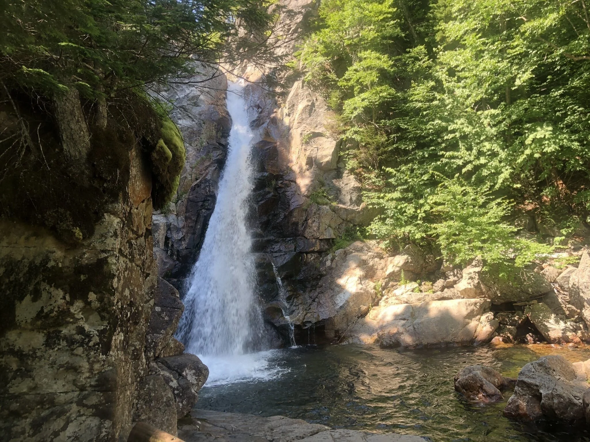
Glen Ellis Falls near Gorham, NH

Photo: AllTrails.com
Local Natural Wonders Day 13 - Glen Ellis Falls near Gorham, NH
Located in the White Mountains region of New Hampshire, Glen Ellis Falls Trail is a short (less than 1/2 mile) out and back hike. The parking lot is located off Route 16, less than 20 miles south of Gorham and 16 miles north of North Conway.
A unique start to this little hike is a tunnel under route 16 to the other side of the road, at which point the trail is mostly alongside Ellis River, leading to the bottom of the impressive 64-foot falls, before heading back. This beautiful hike is one not to be missed, and is equally gorgeous in the wintertime (just be sure to bring crampons, as the trail can be quite icy). MAP and DIRECTIONS
Local Natural Wonders - Day 12
Dodge Point Preserve in Newcastle, Maine

Local Natural Wonders - Day 12 - Dodge Point Preserve, Newcastle, Maine
With over 500 acres, Dodge Point offers over 8,000 feet of frontage along the Damariscotta River and has secluded beaches and River views as well as a diversified environment with many species of plants and animals. It has a trail system with over 6 miles of hiking trails through a variety of ecosystems.
More about the trails from AllTrails.com:
Old Farm Road Trail (2 mile loop, easy):
The Old Farm Road Trail leaves from the parking lot and traverses the interior of the property. This trail is an easy hike along old farm roads used by farmers in the 1800's and loggers in more recent times. It winds through a mixed growth forest with gentle slopes and a large stand of red pine and along the way passes many old stone walls, remnants of farmer's property boundaries. There is also an ice pond off from this trail that was used by residents of the area during the winter for ice that was used in their ice boxes for cold storage prior to the introduction of electricity. Several trails branch off from this main loop providing access to different areas of the property. In addition, this trail is also an excellent trail for snowshoeing and cross-country skiing in the winter.
Shore Trail (1.5 miles, easy): The Shore Trail spurs off the Old Farm Road and follows the shores of the Damariscotta River. It is the most popular trail, and hikers can access a sand beach and a pebble beach for swimming to cool off on hot summer days. Visitors can also picnic on the river bank while observing many species of shore birds such as egrets, ospreys, herons, and eagles.
For Directions and More information about the history of this preserve check out this website.
Local Natural Wonders - Day 11
Mt. Apatite Park in Auburn, Maine

Photo: City of Auburn
Local Natural Wonders Day 11 - Mt. Apatite Park in Auburn, Maine
Mt. Apatite Park is a 325-acre wooded park located with four miles of trails that can be used for hiking, mountain biking, cross-country skiing and snowshoeing. The park, owned by the City of Auburn was named after the mineral apatite, which was found there. There is much to explore in this park, including water-filled quarries.
There is ample parking at 64 Mount Apatite Park Rd in Auburn. To access the trails, walk past the Army National Guard buildings to the wooded area. TRAIL MAP
From City of Auburn website: The park offers a wide variety of recreational opportunities not often found in municipal park settings. "Rock hounds" have known about this area for over 150 years, when the first discoveries of gem-quality tourmaline were found there. Since then, the area has experienced a great deal of mineral exploration, both commercial and amateur. Today amateurs may still search the mine tailings for apatite, tourmaline, and quartz specimens (special rules apply).
Geology from City of Auburn website: Exploration of Mount Apatite began as early as 1839 when records show that three specimens of tourmaline were added to the collection of the Maine State Geologist. Over the course of the next 100 years, some remarkable finds have added to the renown of Mt. Apatite as a great place to look for semi-precious stones and other minerals.
In the 1880s, some 1500 tourmaline crystals were removed from an exploratory mine here. These varied in length from ½” to 4”, occurring in lovely shades of pastel pink, blue, lilac, yellow and green. The American Museum of Natural History in New York City displays an exquisite green rectangular tourmaline stone weighing 11.87 carats that was cut from Mt. Apatite.
In 1902, the Maine Feldspar Company began mining feldspar at Mt. Apatite. During this early period, a massive crystal of smoky quartz of approximately 19 ½” long and 9 ½” thick was discovered. Large masses of flawless material may be seen in this specimen,which is deep amber in color. This makes up the heart of the museum display at Perham’s of West Paris.
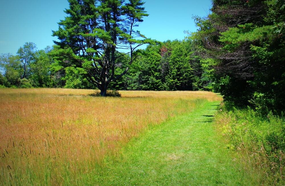
Local Natural Wonders - Day 10
Chandler Brook Preserve in North Yarmouth, Maine

Photo: Alltrails.com
Local Natural Wonders Day 10 - Chandler Brook Preserve in North Yarmouth, Maine
Chandler Brook Preserve has 2.9 miles of fairly flat trails that loop around the 65-acre property that borders Chandler Brook. Trails go through the forest, along the brook and along the mowed borders of the adjacent fields. This is a great, easy hike for kids and the perfect spot for dogs to run (and no dogs do not need to be leashed, but please clean up after them).
Directions from Royal River Conservation Trust:
All trails are easily accessed from the parking area and trailhead on North Road in North Yarmouth. To get there from the intersection of North Road and Memorial Highway (Route 9) in North Yarmouth: drive one mile north on North Road, take a right onto a gravel driveway when you see a blue “Chandler Brook Preserve” sign. Stay left as the driveway forks. A small parking lot for preserve users is at the end of the driveway, just before a railroad crossing and kiosk. GPS address: 1409 North Road, North Yarmouth.
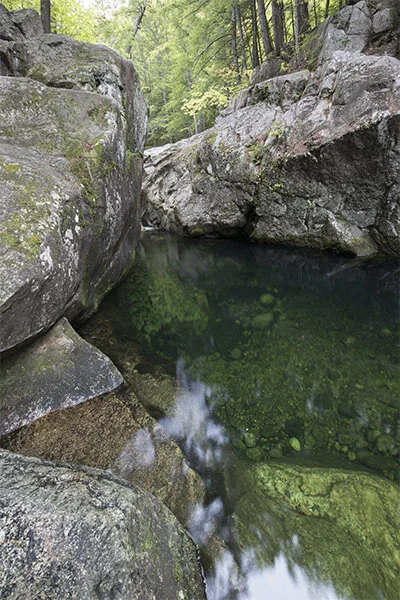
Local Natural Wonders - Day 9
Emerald Pool in Chatham, NH

Local Natural Wonders - Day 9 - Emerald Pool in Chatham, NH
Just over the Maine border in New Hamshire is a short hike to this unique swimming hole. This easy hike is 1.6 miles out-and-back and leads to a small cascade with a striking emerald green pool. If you are a more experienced hiker, this trip could be combined with a much longer hike on the Baldface Circle Trail, or an easy backpacking adventure to the South Baldface Shelter.
About the Hike from newhampshirefamilyhikes.com:
The beauty of Emerald Pool is not in its small cascade, but in the lovely green hue of the pool below it. A small gorge above the pool creates a few small cascades. Below the cascades, the rock opens up into a bowl where the picturesque green water swirls around. Reached by a pleasant walk through the woods on the bottom section of the Baldface Circle Trail, Emerald Pool is a fine side trip to any adventure in the Evans Notch region. Hike 0.7 miles up Baldface Circle Trail to a trail intersection known as Circle Junction. Turn right here at a sign for Emerald Pool and follow the beaten paths 0.1 miles down to Emerald Pool.
Click here for directions: Printable directions pa
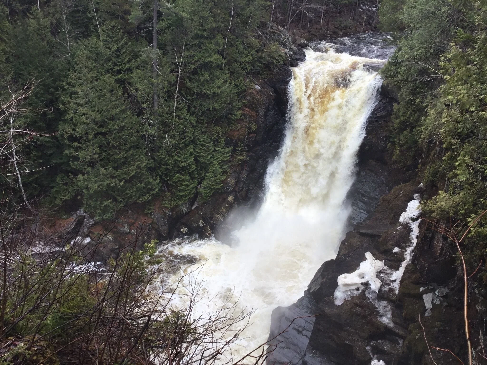
Local Natural Wonders - Day 8
Moxie Falls, Moxie Gore Township, ME

Photo credit: Smelt sherpa on Alltrails.com
Local Natural Wonders Day 8 - Moxie Falls, Moxie Gore Township, ME
Moxie Falls Trail is an fairly easy out-and-back hike, totaling about 1.7 miles. It is kid and dog friendly (though dogs should be leashed). The trail leads to Moxie Falls Moxie, an incredible waterfall with a 90 foot vertical drop into a pool about 17 feet deep. Moxie Falls is one of the highest falls in New England. The falls are part of Moxie Stream which flows from Moxie Pond into the Kennebec River approximately 1 kilometer downstream the falls. Bring bug spray, pack a lunch and enjoy this beautiful spot!
The township of Moxie Gore is located approximately 50 miles north of Skowhegan on US Route 201. Upon reaching the small village of The Forks, look to turn right onto Moxie Pond Road (Lake Moxie Rd on DeLorme's Maine Atlas & Gazetteer). This paved road is immediately before the bridge over the Kennebec River. There is a rest area between the Moxie Pond Road and the river. The trailhead is located approximately 2.3 miles further on this road on the left.