

Local Natural Wonders - Day 52
Ocean Path Trail in Bar Harbor, Maine
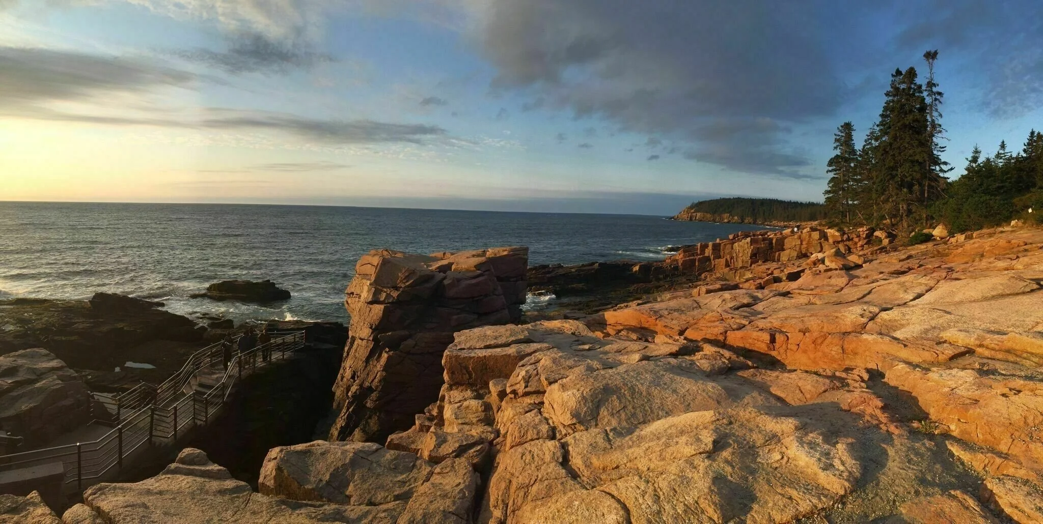
Photo: Alltrails.com, Jenny Pon
Local Natural Wonders Day 52 - Ocean Path Trail in Bar Harbor, Maine
Ocean Path Trail is an easy, flat 2.2 mile trail that takes you along the shore and mostly parallels the Loop Road in Acadia National Park. There are numerous scenic views as well as access to the rocky shore. Along this trail two major natural attractions can be found: Thunder Hole and Otter Cliff. This trail can have a bit more traffic, so if you prefer quieter times, try early or late in the day.
More on exploring along the path from Alltrails.com: Half-way between Sand Beach and Otter Cliff is Thunder Hole. Waves and tides dictate whether you hear the sound like thunder or whether you'll hear a whisper of waves crashing below. Granite stairs and railings lead to the viewing area. Half way between Thunder Hole and Otter Cliffs on the right side of the Park Loop Road, is the small parking area for the Gorham Mountain Trail, which offers spectacular panoramic views of the eastern coastline. From this vantage point (another 2 mi. RT deviation to the summit), you can see from Sand Beach to the north and all the way south to Otter Cliff. At the southern end of the path is Otter Cliff. Just before Otter Cliff is Monument Cove. Look for the short side trail on the left as there are some great photo ops from this vantage point, especially when the first light of the morning turns the cliffs a golden color. Rock climbers and rappellers frequent the Otter Cliff. This is a great hike - take as little or as much time as you like to explore!
Local Natural Wonders - Day 51
Angel Falls in Township D, Maine
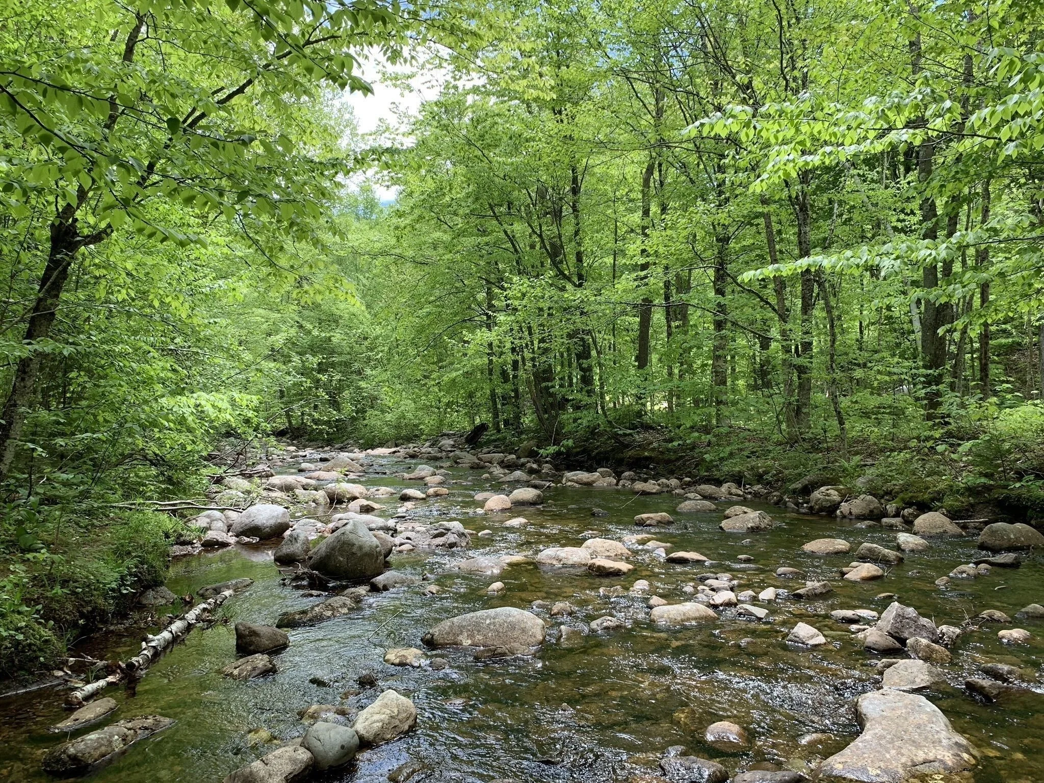
Photo: Alltrails.com, Nikki Roderiguez
Local Natural Wonders Day 51 - Angel Falls in Township D, Maine
Getting to Angel Falls is not easy, but the spectacular falls are worth the few miles of driving on gravel roads and several creek crossings on the trail. The trail itself is one mile out and back and only rises about 250 feet in elevation. Crossing the creeks may require some rock hopping, and when the water is low it is easy to stay dry. If the water is a bit higher, it may be necessary to wade across (ankle to knee deep). The water can get quite high with stronger currents after a lot of rain, so it may be best to avoid this trail during those times.
The 90-foot tiered waterfall is named “Angel Falls” because some say it takes the shape of an angel when the water flow is right. 115-foot high cliffs surround the falls and on a hot day, a refreshing dip in the pool below the falls is quite refreshing. Angel Falls is a Maine natural wonder not to be missed!
Route 17 to Bemis Rd will take you to the trail head, but it is not highly visible, so be on the lookout for it.
Local Natural Wonders - Day 50
Streaked Mountain near Buckfield, Maine

Photo: alltrails,com, Beth Malchowsky
Local Natural Wonders Day 50 - Streaked Mountain in Buckfield, Maine
Just under 700 feet in elevation, Streaked Mountain offers a 1.1 mile out and back trail (Streaked Mountain Trail) that is a bit challenging, but offers beautiful views and plenty of wildflowers to enjoy. The first part of the trail is wooded and one should watch out for prominent roots and loose rocks underfoot. As the trail continues up the steep granite face of the mountain (this is where it gets a bit more challenging), wild blueberries can be found all over in the month of August. At the summit, you will find some power lines and towers, but the incredible views of surrounding peaks, including Mount Washington in NH seem to make up for that. Streaked Mountain Trail connects to several other trails and mountains, so there is the option to keep going (but be sure you have a trail map and preferably a compass with you).
Streaked Mountain is located between Hebron, South Paris and Buckfield, and the Streaked Mountain Trail can be accessed from Buckfield Road.
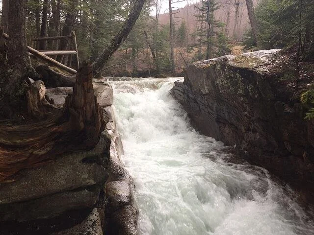
Local Natural Wonders - Day 49
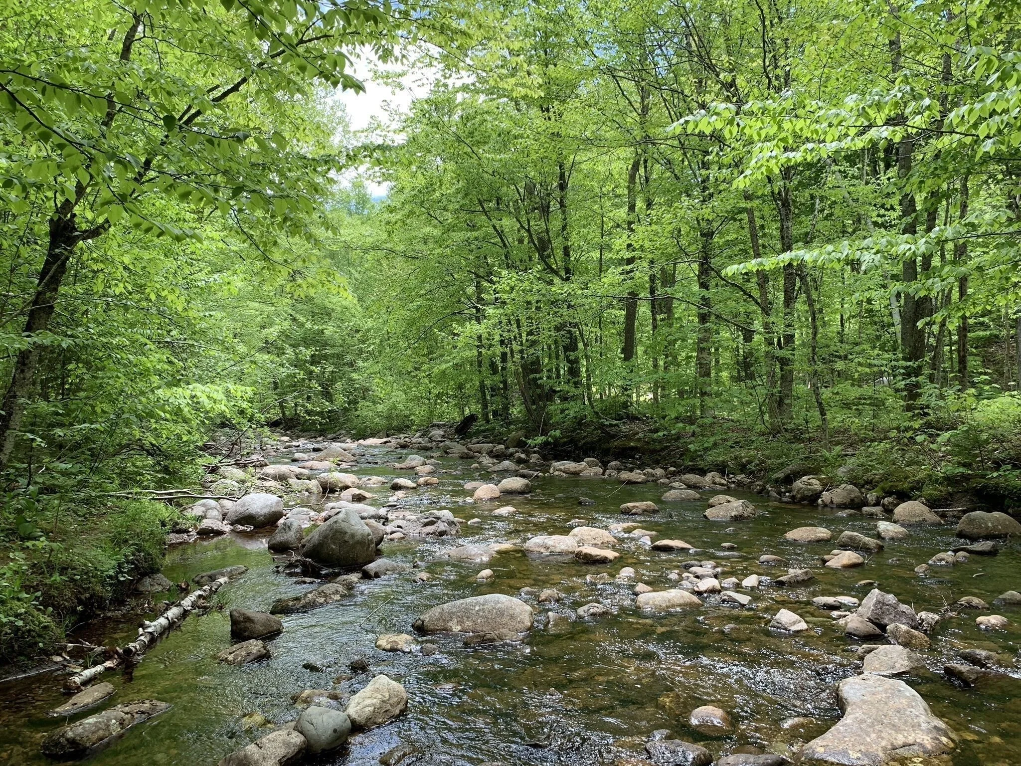
Basin-Cascades Trail in Lincoln, New Hampshire

Local Natural Wonders - Day 49 - Basin-Cascades Trail in Lincoln, New Hampshire
Right in the heart of the White Mountains, this trail offers several interesting geologic formations and beautiful waterfalls. With plenty of scenic spots to stop for a picnic or dip your feet in a cold mountain stream, this is an excellent hike for all ages.
From the parking area, walk down the paved walkways into the Basin. Cross the bridge over the river, passing a powerful cascade. Follow the path past a beautiful aqua-tinted pool with a sand beach and along the river, by more cascades and smoothed rock waterways. Continue down to the main attraction, The Basin, an amazing curved waterfall through carved rock into a huge, swirling pool underneath a half-domed rock ceiling. Just past The Basin, cross a bridge and bear right off the paved path onto Basin-Cascades Trail. Pass Pemi Trail on the right and continue at easy grades through the woods, heading toward Cascade Brook. The trail quickly reaches the brook and follows it closely, passing many beautiful sets of cascades, where there are opportunities to walk out onto the rocky brook bed and explore. One notable unnamed waterfall spans the width of the brook as it tumbles and slides into a huge pool. Not far past this, 0.4 miles from the paths in the Basin, a spur on the left descends to Kinsman Falls, a straight, narrow plunge over a small cliff. The trail then passes by the top of the waterfall.
In 0.1 miles, the trail crosses the brook on medium-sized rocks and climbs a steep pitch on the other side. It continues to follow the brook closely, passing a few more exciting cascades before the trail (and the brook) levels somewhat. The trail then continues uphill to a viewpoint overlooking Rocky Glen Falls (just off the trail), whose name suits it well. Just past this, turn right and step down into a gorge to get a closer look at the waterfall. The brook is walled in above and below this picturesque waterfall. This is 0.4 miles from the brook crossing. For a longer and even more scenic hike, continue to Lonesome Lake.
Directions:
Trailhead and parking area are at The Basin, off Rt. 93 in Lincoln, NH. The Basin exit is 2.1 miles north of exit 34A and 3.4 miles south of Exit 34B. Parking is available on both sides of the highway, but is most convenient (and the trail directions are described from) the west (southbound) side. If traveling north, you can reverse direction at exit 34B.
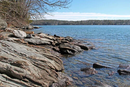
Local Natural Wonders - Day 48
Dodge Point in Newcastle, Maine

Photo: alltrails,com
Local Natural Wonders Day 48 - Dodge Point In Newcastle, Maine
Dodge Point offers over 500 acres and 8,000 feet of frontage along the Damariscotta River with several trails, three secluded small beaches and many species of plants and animals. Choose from four different trails, ranging in difficulty from easy to moderate and 0.8 to 2 miles and enjoy the red pines and coastal vistas on your hike.
At one time this land was a tree farm. The State of Maine purchased it in 1989, with help and funding from the Damariscotta River Association, the Maine Coastal Program, and the Land for Maine’s Future Program.
Directions from Maine Trail Finder:
From North: Take Newcastle exit off US Route 1 and turn left on Mills Road. Follow the road for 0.5 miles. At the stop sign, head straight following River Road for 2 miles. The parking lot and trailhead will be on your left.
From South: Take Newcastle exit off US Route 1. At end of off ramp, turn right onto River Road, follow for 2 miles. The parking lot and trailhead will be on your left.
River~Link Trailhead: In the case that there is no available parking at the primary trailhead, the Dodge Point trails are also accessible from a parking lot for the River~Link trailhead, which is 0.5 south on River Road from the Dodge Point parking lot.
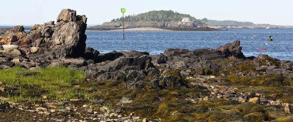
Local Natural Wonders - Day 47
Pott’s Point Preserve in Harpswell, Maine

Local Natural Wonders - Day 47 - Pott’s Point Preserve in Harpswell, Maine
If you love exploring the ocean shoreline, this tiny preserve has just about everything you could want. There are extensive tide pools to explore, a gravel beach and dramatic views of Casco Bay. Tide pools along the shoreline teem with life. You might be able to spot barnacles, oysters, crabs, shrimp, periwinkles, hermit crabs, star fish, sea urchins and the occasional lobster or squid. All live in these small pools, surviving the cycle of the tides and nestled within a bed of assorted seaweeds and kelp. This is a great place to explore with your family, relax on the beach, take a swim or read a good book (Harpswell Heritage Land Trust.)
Directions:
Click here to get directions from Google Maps.
Parking for Potts Point Preserve is located at the southern end of Harpswell Neck Road, Harpswell. From the intersection of Rt 123 and Bath Rd at Bowdoin College in Brunswick, follow Rt 123 south 13.9 miles to the end of Rt 123. Park by the side of the road, but please do not block access to any buildings or businesses or the town landing. Walk along private Potts Point Rd to the Preserve. You may also walk along the shore below the high tide line.
Local Natural Wonders - Day 46
Ovens Mouth Preserve in Edgecomb, Maine

Photo: mainetrailfinder.com
Local Natural Wonders Day 46 - Ovens Mouth Preserve in Edgecomb, ME
This 146-acre preserve is bordered by tidal waters, salt marsh, and coves and offers over 5 miles of various level hiking trails on two peninsulas, connected by a 93-foot footbridge. “Ice House Cove” is located on the Boothbay side of the preserve. In 1880 the demand for ice was growing, and so this cove was damned to form a fresh water pond. An ice house was built and ice was shipped to Boston and New York by schooner. Today, when standing on the bridge that connects the two peninsulas of the preserve, you can see what’s left of the dam. A salt marsh now exists where the ice pond once was.
From Boothbay Region Land Trust: “Ovens Mouth Preserve is comprised of two distinct peninsulas connected by a pedestrian bridge. This preserve features BRLT’s most extensive trail system with over 5 miles of hiking trails in total. Both the East and West sections of Ovens Mouth are heavily wooded and feature partial water frontage and shoreline trails, quiet coves, and salt marsh, as well as stunning areas for picnicking, nature studies and watching the dramatic tidal change of the Ovens Mouth passage.”
Directions for Ovens Mouth East: From the roundabout at Boothbay Center, travel north on Route 27 for 1.6 miles. Take a left onto Adams Pond Road. Proceed .1 miles. Turn right onto Dover Road. Continue 1.9 miles and bear right onto Dover Ext. Parking is on the left at the end.
Directions for Ovens Mouth West: See Ovens Mouth East but go only 1.9 miles on Dover Road and bear left onto Dover Cross Road. The parking lot is 0.2 mile on the right.
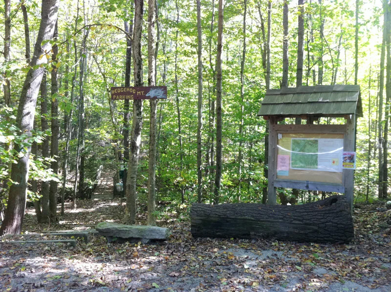
Local Natural Wonders - Day 45
Hedgehog Mtn in Freeport, Maine

Photo: https://freeportconservationtrust.org/
Local Natural Wonders - Day 45
Hedgehog Mountain offers five miles of trails and 196 acres with a 2.8 mile loop trail to the summit in Freeport, Maine. Owned by the Town of Freeport, this little mountain is perfect for hiking with children, mountain biking, trail running, cross country skiing and snowshoeing. The summit provides a narrow view of Mt. Washington and Mt. Jefferson, as well as local mountains, Pleasant and Bradbury. Dogs are welcome here but must be kept on a leash or on voice command. This is a nice little hike with a few short steeper areas, accessible to most skill levels. If you are looking for a convenient, beautiful, easy walk in the woods with little change in elevation, Hedgehog Mountain is perfect spot to visit.
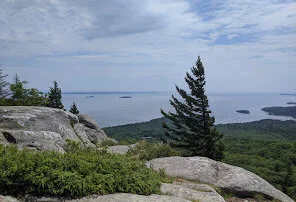
Local Natural Wonders - Day 44
Camden Hills State Park in Camden, Maine

Local Natural Wonders - Day 44 - Camden Hills State Park in Camden, Maine
Camden Hills State Park is a 5,710-acre public recreation area overlooking Penobscot Bay in the town of Camden, Knox County, Maine. The state park features multi-use trails to Mount Battie, Mount Megunticook, and other scenic locales. The park is managed by the Maine Department of Agriculture, Conservation and Forestry. Best known for the scenic vista high atop Mt. Battie with its sweeping views of Camden, Penobscot Bay, and surrounding islands. Mt. Megunticook, the highest of the Camden Hills is a moderate climb by foot trail and plenty of other hikes abound at this park as well.
For information about all the trails and the campground and for directions check out Maine.gov
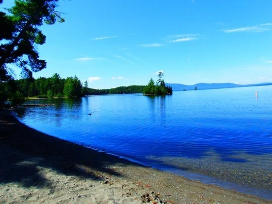
Local Natural Wonders - Day 43
Lily Bay State Park in Greenville, Maine

Local Natural Wonders Day 43 - Lily Bay State Park in Greenville, Maine
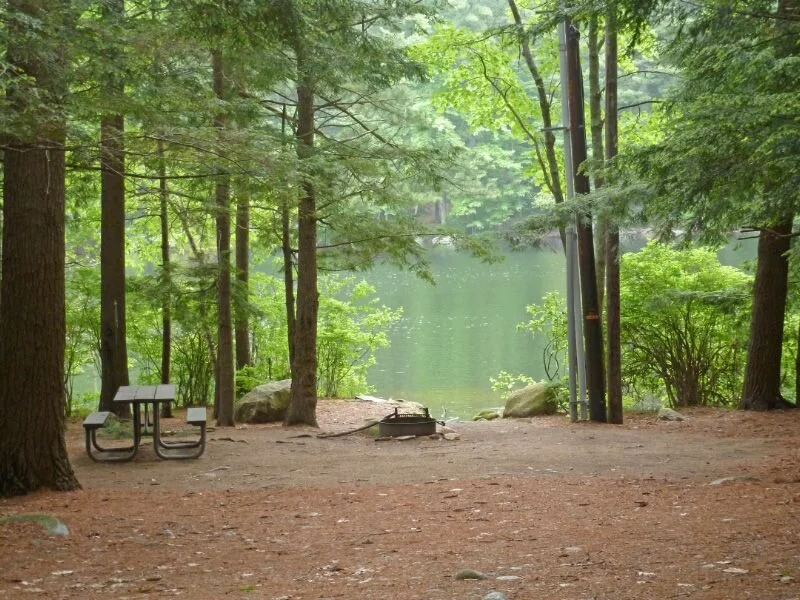
Lily Bay State Park is located on the northeast shore of Moosehead Lake, with gorgeous views of Moose Mountain, access to Kokadjo and nearby hiking, and paddling to Sugar Island. There is a flat two-mile trail that follows along the shoreline from the beach to Rowell Cove campground that offers scenic views of Moosehead Lake. Amenities include a swim beach, playground, two trailerable boat ramps with boat slips. Camping is available at Rowell Cove and Dunn Beach.
Directions from State Parks website: Nine miles north of Greenville on the east shore of Moosehead Lake. From Routes 15/6 in the center of Greenville, head north 9 miles on the Lily Bay Road that follows Moosehead Lake's east shore to North State Park Road (on left).
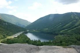
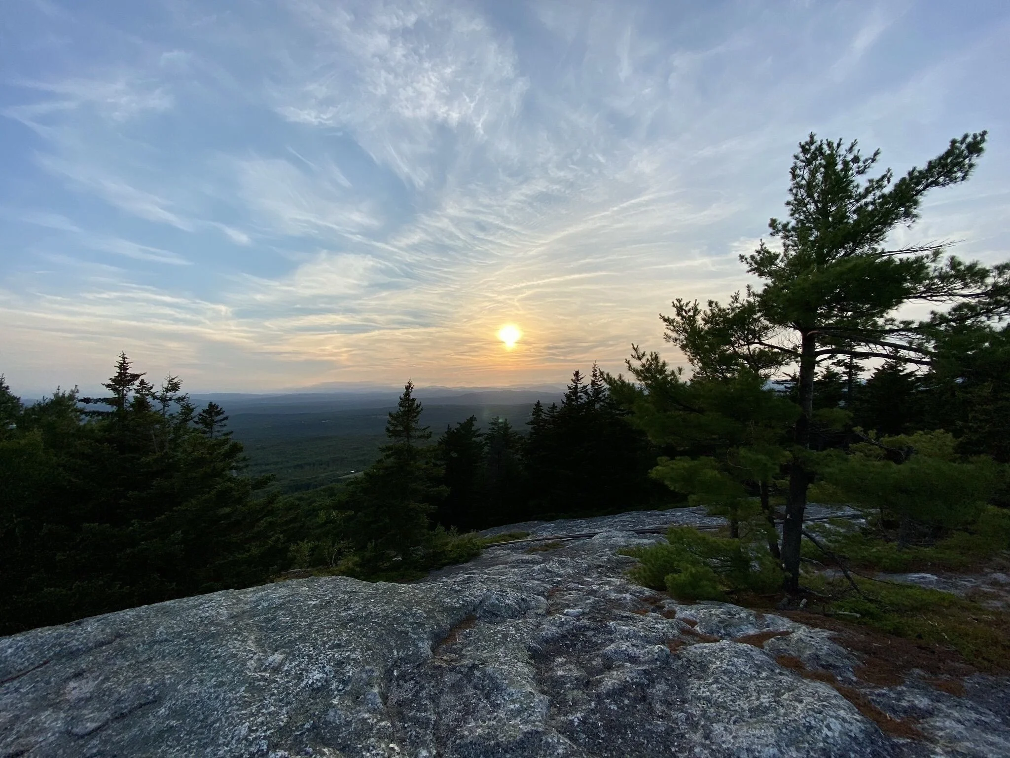
Local Natural Wonders - Day 42
Bald Mountain and Artists Bluff in Franconia, NH

Local Natural Wonders - Day 42 - Bald Mountain and Artists Bluff in Franconia, NH
This beautiful hike is in the heart of Fanconia Notch in New Hampshire. It is short, but steep at times, and opens to a spectacular view of Franconia Notch State Park, Cannon Mountain and Echo lake. This is the perfect hike to find incredible views of the park and some amazing foliage in autumn.
From The Outdoor Project:
There are a few options for hiking here, including an out-and-back hike to either Artists Bluff or to Bald Mountain, or a loop to do both.
Starting from the parking area for Echo Lake Beach, a sign across the road marks the start of the shortest, easiest route to Artists Bluff. This trail is a good option if you just want to do Artists Bluff and return the way you came. While a short hike, it still goes uphill and has some rocky terrain, so very young children may need a hand in spots.
The loop option involves parking a little further up on Route 18 across from the Peabody Base Lodge. From here, a quarter-mile hike brings you to a junction where you can bear left to do a very short side trip to Bald Mountain, which lives up to its name with its open, rocky summit. Bearing right at the junction brings you along a ridge and has a section of steep descent, and it eventually leads to the overlook at Artists Bluff. Kids will enjoy scrambling around on the rocks, and this is a scenic place to have lunch or a snack. While this viewpoint overlooks Interstate 93, it also looks out at the ski slopes on Cannon Mountain as well as Echo Lake down below. This is a very popular hike in the fall to see the changing foliage. As you head down along the loop you’ll reach a junction; the path to the right continues in and out of the woods, parallels the road, and brings you back to the trailhead.
Local Natural Wonders - Day 41
Pawtuckaway State Park near Raymond, NH

Photo credit: https://www.pinterest.com/pin/78250112250750672/
Local Natural Wonders Day 41 - Pawtuckaway State Park near Raymond, NH
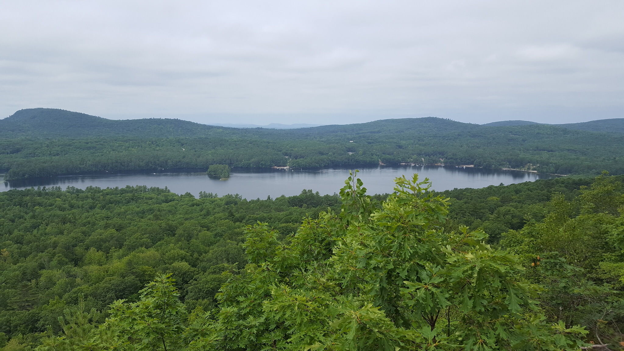
Pawtuckaway State Park is in the Secoast Region of New Hampshire and is the perfect place to spend a day, a couple nights or a week for a perfect outdoor adventure. Camping, hiking, paddling, swimming, fishing, bird and wildlife watching, picnicking, and exploring are among the many activities visitors enjoy at this park. Take a hike to the 1915 fire tower atop South Mountain or spend time at the sandy beach on Pawtuckaway Lake where canoes, paddleboards and kayaks are available to rent. There are numerous ponds, lakes and wetlands to explore, including Burnham’s Marsh - the perfect spot for wildlife and bird watching enthusiasts.
Be sure to visit the State Park website for directions and details before visiting. For some day hikes, reservations may be needed.
Local Natural Wonders - Day 40
Pismire Bluff Trail in Raymond, Maine

Local Natural Wonders Day 40 - Pismire Bluff Trail in Raymond, Maine
Pismire Bluff Trail is a 1.5 mile lightly trafficked out and back, moderately rated trail. Perfect for families and dogs, this short hike offers a steady incline and lovely views of Crescent Lake and Mount Washington. This trail is part of the Raymond Community Forest, and other trails are also available (see the trail map below).
From Loon Echo Land Trust: Raymond Community Forest is a 356 acre permanently conserved preserve in Raymond, ME. With 4 miles of multi-use trails, RCF offers exceptional views of and from Pismire Mountain. Uses in the lower forest include walking, hiking, cross country skiing/snowshoeing and mountain biking. The forest also offers continuation of traditional uses such as hunting. The property has had a long tradition of sustainable forest management which will continue under Loon Echo’s ownership.
Local Natural Wonders - Day 39
Vaughn Woods State Park in South Berwick, Maine

Local Natural Wonders - Day 39 - Vaughn Woods State Park in South Berwick, Maine
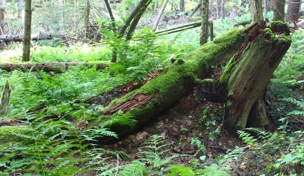
Not to be confused with Vaughn Wood in Hallowell Maine, Vaughn Woods State Park is a 165 acre park along the shores of the Salmon Falls river. This park features hiking trails through beautiful old growth pine and hemlock forests as well as sweeping river views. There are picnic tables and charcoal grills if you want to have a picnic or just explore the hiking trails in this magical forest.
To learn more about the History of this land go to Maine.gov
The trails (from Maine Trail Finder:)
The River Run Trail (0.8 miles): offers a scenic stroll along the Salmon Falls River, which provided transportation for the earliest settlers for their timber harvest. The river was named for the salmon that abounded at the falls during migration as the river connected the interior to the ocean and it also powered the first sawmill built in America.
The Bridle Path Trail (0.7 miles): is the return loop following gently rolling terrain. There are majestic old growth pine and hemlock trees along this trail, many of which are more than a century old. Most of the park was covered with brushy fields and young woods that was less fertile for farmers. In the 1630s, much of this property was bought by Europeans and often given to indentured servants upon completion of their service. James Warren, a Scot, was one of these indentured servants. At the end of his indenture, he settled on a 50-acre lot within the current park where a plaque marks his old home site.
Local Natural Wonders - Day 38
Durham River Park in Durham, Maine

Local Natural Wonders Day 38 - Durham River Park in Durham, Maine
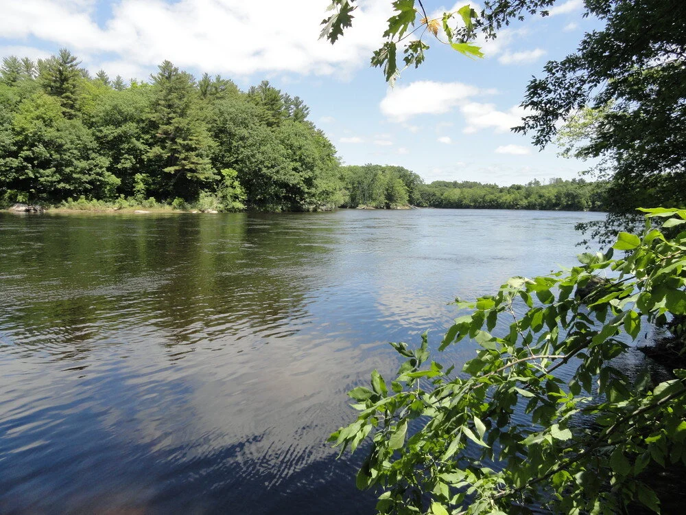
Located just nine miles from Freeport and eight miles from Auburn on Route 136 is Durham River Park, 12 acres own by the Town of Durham, maintained by the Durham Conservation Commission, and open to the public. The park area with picnic tables has three short, easy trails that lead to the beautiful Silver Maple-lined bank of the Androscoggin River. This is a great spot to visit with young children or to fish, swim, or launch a canoe, kayak or paddleboard (carry-in only). Be aware of strong river currents especially when the river is high after periods of rain and in the spring.